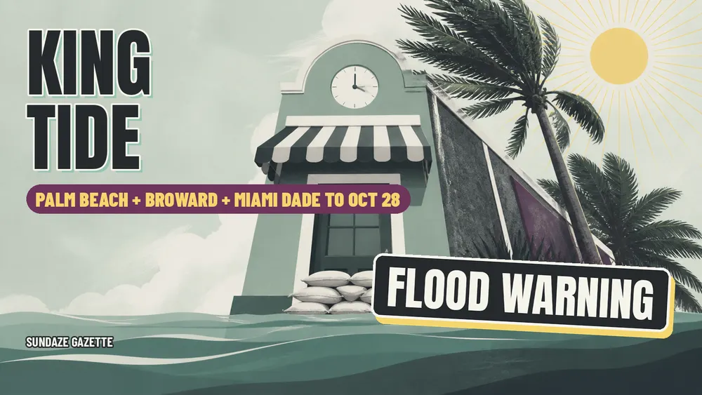
Updated Nov. 2, 2026: The National Weather Service has a Coastal Flood Advisory for coastal Palm Beach and Broward counties until 7 p.m. Tuesday, Nov. 3, and a Flood Watch for inland and metro Palm Beach, Broward and Miami-Dade until 7 p.m. Monday, Nov. 2.
Updated Oct. 28, 2026: The National Weather Service in Miami reissued its coastal alerts at 5:39 a.m. Wednesday, Oct. 28. The Coastal Flood Warning for Coastal Palm Beach County, Coastal Broward and Coastal Miami Dade ends at 8 p.m. Wednesday, and a Coastal Flood Advisory for moderate coastal flooding then runs from 8 p.m. Wednesday to 8 p.m. Thursday, Oct. 29, for all three counties. Thursday tide times are below.
Updated Oct. 27, 2026: The 1:22 a.m. reissue on Tuesday, Oct. 27, added Coastal Palm Beach County to the Coastal Flood Warning.
The water shows up on a schedule. A shop owner on a low block near the beach can watch the morning high tide push up through storm drains, spread across the parking lot and creep toward the front door, then drain away hours later. This week that schedule matters more than usual. The National Weather Service office in Miami first issued a Coastal Flood Warning for Coastal Broward and Coastal Miami Dade at 1:20 a.m. on Monday, Oct. 26, 2026. The 1:22 a.m. reissue on Tuesday, Oct. 27, added Coastal Palm Beach County. The 5:39 a.m. reissue on Wednesday, Oct. 28, ended the warning at 8 p.m. that day and stepped it down to a Coastal Flood Advisory. The advisory has since been extended and now runs through 8 p.m. ET Saturday, Oct. 31, across coastal Palm Beach, Broward and Miami Dade, with a rip current statement through 7 p.m. ET Sunday, Nov. 1.
The NWS Miami warning text called for "significant coastal flooding" and spells out the impacts plainly: "Numerous roads may be closed. Low lying property including homes, businesses, and some critical infrastructure will be inundated. Some shoreline erosion will occur." The advisory that followed calls for "moderate coastal flooding" and carries the same impact language. Earlier in the week, the same office posted a Wind Advisory for northeast winds of 15 to 25 mph with gusts up to 40 mph, which ran until 8 p.m. Tuesday.
For a business owner, the useful question is not whether it floods but when, and what to do in the hours before each high tide. What follows is a practical checklist built on official sources.
When the High Tides Hit
NOAA Tides and Currents publishes predicted high and low tides for local stations. These are astronomical predictions measured against mean lower low water, so actual water levels during the warning can run higher when onshore wind piles water against the coast. Treat the times as the center of the risk window, with flooding often building before and lingering after each peak.
At South Port Everglades in Broward County (station 8722956), NOAA predicts high tides at 8:52 a.m. and 8:59 p.m. on Monday, Oct. 26; 9:40 a.m. and 9:46 p.m. on Tuesday, Oct. 27; 10:30 a.m. and 10:36 p.m. on Wednesday, Oct. 28; and 11:23 a.m. and 11:30 p.m. on Thursday, Oct. 29. Predicted morning peaks there run about 3.7 feet.
At Virginia Key in Miami Dade County (station 8723214), NOAA predicts high tides at 9:44 a.m. and 9:48 p.m. on Monday; 10:31 a.m. and 10:34 p.m. on Tuesday; 11:20 a.m. and 11:23 p.m. on Wednesday; and 12:11 p.m. on Thursday. Predicted morning peaks there run about 3 feet.
At the Port of West Palm Beach in Palm Beach County (station 8722588), NOAA predicts high tides at 9:38 a.m. and 9:45 p.m. on Tuesday, Oct. 27; 10:28 a.m. and 10:35 p.m. on Wednesday, Oct. 28; and 11:20 a.m. and 11:29 p.m. on Thursday, Oct. 29. Predicted morning peaks there run about 4.1 to 4.2 feet.
For the rest of the advisory, NOAA predicts daytime high tides at 12:16 p.m. Friday, Oct. 30, and 1:14 p.m. Saturday, Oct. 31, at the Port of West Palm Beach; 12:19 p.m. Friday and 1:19 p.m. Saturday at South Port Everglades; and 1:07 p.m. Friday and 2:05 p.m. Saturday at Virginia Key. Overnight highs come at about 12:30 a.m. Saturday at the two northern stations and 1:16 a.m. Saturday at Virginia Key.
Two patterns stand out. The daytime tides are the higher of each day at all three stations, and each high tide arrives roughly 45 minutes later than the day before. Local streets, canals and bays can lag or lead these stations, so owners should watch their own block during the first cycle and adjust.
Protect the Storefront and Inventory
The warning tells residents to "take the necessary actions to protect flood-prone property." For a storefront, that work is cheapest before the first high tide.
- Move inventory, files and electronics off the floor and onto shelves, tables or upper floors.
- Unplug floor level equipment and move power strips, routers and point of sale gear up and away from water.
- Place sandbags, flood barriers or door dams at thresholds that have flooded before.
- Clear drains, gutters and scuppers so water has a path out.
- Bring in sidewalk signs, outdoor furniture, planters and trash cans, since gusts up to 40 mph can turn them into hazards.
- Park company vehicles on higher ground, away from low streets and garage ramps that take water.
Salt water damages more than drywall. It corrodes electrical systems, compressors and vehicle undercarriages, so keeping equipment and cars out of it is often the bigger savings.
Deliveries, Staffing and Road Closures
The warning expects that numerous roads may be closed, and its instruction is direct: "If travel is required, do not drive around barricades or through water of unknown depth."
That makes timing the main tool. Ask suppliers to shift deliveries away from the morning high tide window at your nearest station, and give drivers an alternate route that avoids your lowest streets. Restaurants and retailers that open midmorning may want to stagger shifts so staff arrive after the peak passes, or plan a later opening on the worst days.
Tell customers early. A short note on your website, social accounts and voicemail about adjusted hours, flooded entrances or a side door saves frustration. Employees who drive low lying routes should know they are not expected to push through water, and managers should have a call tree ready if a street becomes impassable.
Document Damage for Insurance
If water gets in, photographs and records become the backbone of any claim. Before the next high tide, take dated photos and video of the storefront, stock and equipment so there is a baseline. After the water recedes, photograph the waterline on walls, damaged inventory and equipment before cleaning or discarding anything.
Keep receipts for cleanup, emergency repairs and supplies. Make a written list of damaged items with quantities and approximate values, and pull invoices or inventory reports that support them. Contact your insurance agent or carrier promptly to report the loss and ask what they need. Lost revenue from closed roads or a shuttered day may fall under business interruption coverage in some commercial policies, so it is worth asking the agent how your specific policy treats it.
Flood Coverage and the 30 Day Wait
Standard commercial property policies often exclude flood, which is why many owners carry a separate flood policy. The National Flood Insurance Program sells both building and contents coverage for commercial property through insurance agents.
Timing is the catch for anyone shopping now. According to FloodSmart, the official NFIP site, "your flood insurance coverage will go into effect 30 days after your date of purchase." The federal rule at 44 CFR 61.11 sets the same standard. FloodSmart lists exceptions, including no wait when coverage is bought while making, increasing, extending or renewing a mortgage, and a one day wait for property in a newly designated high risk flood zone when the policy is bought within 12 months of the map update.
In practical terms, a policy bought now will not cover this week's king tides. It can still protect against later flooding, including the rest of hurricane season and future tide cycles. Owners who already carry flood coverage should confirm their limits, deductibles and whether contents are included.
Where to Report Flooding
Report street flooding and blocked drains to local government so crews can respond.
In Miami Dade County, residents can call 311 or submit a request online through Miami Dade 311. The county says the 311 Contact Center is open Monday through Friday from 7 a.m. to 7 p.m. and Saturday from 8 a.m. to 5 p.m., and closed on Sundays and holidays.
In Broward County, the county website says flooding can be reported by calling 311 or the Highway and Bridge Maintenance Division at (954) 357 6040. In Palm Beach County and inside any city, businesses should also contact their city's public works or customer service office.
In Miami Beach, the City of Miami Beach lists its main line as 305 604 CITY (2489).
Owners in Miami Beach planning ahead can also note the walk in help at Miami Beach Business Ready Day on Nov. 19. Those weighing building costs and resilience can read about Miami's permit fast track, and building owners watching insurance pressure can see how defect lawsuits are hitting South Florida towers.
Sources
- National Weather Service, Coastal Flood Warning and Coastal Flood Advisory, Coastal Broward and Coastal Miami Dade, reissued Oct. 28, 2026
- National Weather Service, Coastal Flood Warning, Coastal Flood Advisory and High Surf Advisory, Coastal Palm Beach, reissued Oct. 28, 2026
- National Weather Service Miami
- NOAA Tides and Currents, South Port Everglades station 8722956
- NOAA Tides and Currents, Virginia Key station 8723214
- NOAA Tides and Currents, Port of West Palm Beach station 8722588
- FloodSmart, Buy a Flood Insurance Policy
- 44 CFR 61.11, Effective date of coverage
- Miami Dade County 311
- Broward County
- City of Miami Beach
Related
- Miami Beach Business Ready Day, Nov. 19
- Miami Permit Fast Track Builder Guide
- Defect Lawsuits Hit South Florida Luxury Towers
Key Facts
How long do the king tide flood warning and advisory last?
The National Weather Service in Miami first issued the warning on Oct. 26, 2026, and added Coastal Palm Beach County on Oct. 27. The warning ended at 8 p.m. Wednesday, Oct. 28. A Coastal Flood Advisory for coastal Palm Beach, Broward and Miami Dade now runs through 8 p.m. ET Saturday, Oct. 31, and a rip current statement runs through 7 p.m. ET Sunday, Nov. 1.
When are the high tides in Palm Beach, Broward and Miami Dade?
NOAA predicts Port of West Palm Beach high tides at 12:16 p.m. Friday, Oct. 30, and 1:14 p.m. Saturday, Oct. 31. South Port Everglades peaks come at 12:19 p.m. Friday and 1:19 p.m. Saturday, and Virginia Key at 1:07 p.m. Friday and 2:05 p.m. Saturday. Overnight high tides fall about 12 hours apart from these, and the daytime tides run higher.
What should business owners do before high tide?
Move inventory, files and electronics off the floor, unplug floor level equipment and place sandbags or barriers at doors that have flooded before. Clear drains, bring in signs and outdoor furniture ahead of gusts up to 40 mph, and park company vehicles on higher ground. Shift deliveries and staff arrivals away from the morning high tide.
Will a new flood insurance policy cover this week's flooding?
Generally no. FloodSmart, the official National Flood Insurance Program site, says coverage goes into effect 30 days after the date of purchase. Exceptions include buying while making, increasing, extending or renewing a mortgage, and a one day wait for newly designated high risk zones. A policy bought now can still cover later flooding events.
Where can owners report street flooding?
In Miami Dade County, call 311 or file a request through Miami Dade 311 online, open weekdays 7 a.m. to 7 p.m. and Saturdays 8 a.m. to 5 p.m. Broward County says flooding can be reported to 311 or the Highway and Bridge Maintenance Division at (954) 357 6040. Miami Beach lists 305 604 CITY.